

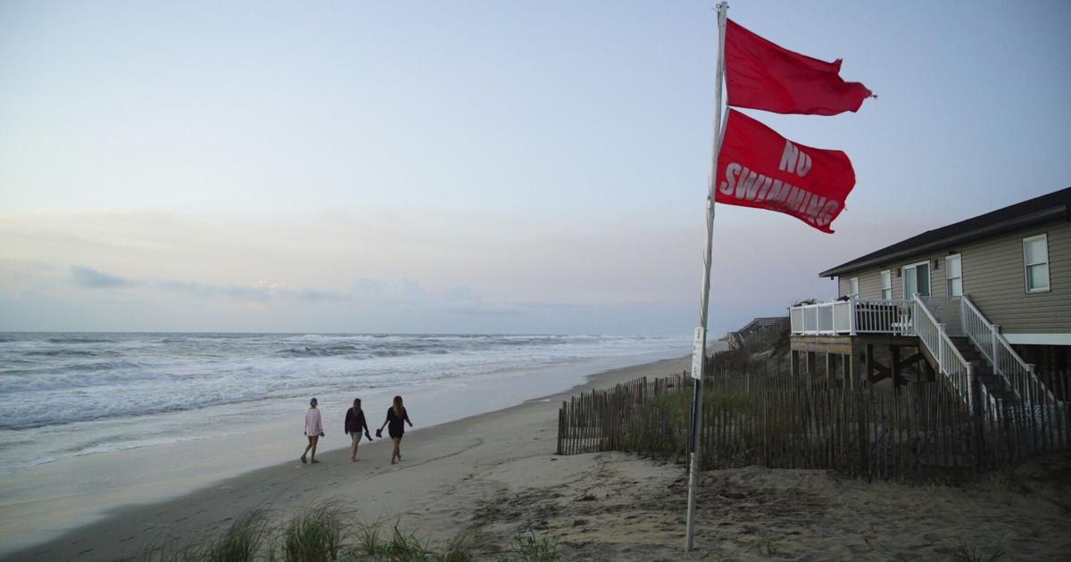

Hurricane Erin pounded the North Carolina coast with strong waves and gusty winds as it slowly moved out to sea Thursday. It was still considered dangerous for beachgoers along the U.S. East Coast.
Erin lost some strength Tuesday and dropped to a Category 2 hurricane as it moved northward, roughly parallel to the East Coast. However, its maximum sustained winds were around 100 mph (160 kph) on Thursday. Erin could become a major hurricane again before finally weakening by Friday, the National Hurricane Center in Miami said.
The hurricane was about 260 miles (420 kilometers) east of Cape Hatteras, North Carolina, late Thursday morning and was moving north-northeast at 18 mph (29 kph).
Although the weather center was confident Erin would not make direct landfall in the United States, authorities warned that water conditions along the East Coast remain dangerous.
Officials on a few islands along North Carolina’s Outer Banks issued evacuation orders. The orders come at the height of tourist season on the thin stretch of low-lying barrier islands that juts far into the Atlantic Ocean. By Wednesday evening, officials had closed Highway 12 on Hatteras Island as the surge increased and waves rose. Ocracoke Island’s connection to its ferry terminal was cut off.
In the Caribbean, heavy rainfall earlier struck parts of the southeast Bahamas and the Turks and Caicos Islands, the weather center said.
Here is what to know about Hurricane Erin:
The dangers in the Outer Banks
Erin poses the biggest threat to the barrier islands of North Carolina’s Outer Banks. Gov. Josh Stein declared a state of emergency Tuesday in advance of the storm.
The storm brought dangerous waves and rip currents to the state. There was a sustained wind of 45 mph (72 kph) and a gust to 54 mph (87 kph) measured at Jennette’s Pier in Nags Head, North Carolina, the weather center said.
The state had mobilized 200 National Guard troops along the coast, as well as three swift water rescue teams as part of its preparations.
At least 75 people were rescued from rip currents through Tuesday in Wrightsville Beach, near Wilmington, North Carolina, officials said.
Two houses are sitting precariously amid the high waves in Rodanthe, where at least 11 other houses have toppled into the surf over the past five years. Ocean waves take away sand that is packed around the wooden pilings that keep the homes above water.
Troubled waters force rescues
Water floods a road in Naguabo, Puerto Rico, as Hurricane Erin brings rain to the island, Sunday, Aug. 17, 2025. (AP Photo/Alejandro Granadillo)
Water floods a road in Naguabo, Puerto Rico, as Hurricane Erin brings rain to the island, Sunday, Aug. 17, 2025. (AP Photo/Alejandro Granadillo)
In this image taken from the North Carolina Department of Transportation camera, cars are lined up to evacuate via ferry from Ocracoke Island to Hatteras Island,